Drones and disaster relief
How flying tech and Cisco Tactical Operations are helping aid disaster zones.
With heat rising around the world, wildfires can start in an instant and ravage sites across the globe. In October of last year, 170 wildfires spread across 245,000 acres in Northern California, destroying at least 8,900 structures. To put that in perspective, thats roughly a quarter of the size of The Grand Canyon National Park.
Another California-based fires, the Mendocino Complex Fire, which started in July of this year, is now the biggest in California history, burning more than 432,000 acres. While firetrucks and helicopters are used to fight flames, the recent surge of fires may need the extra help of newer technology like drones.
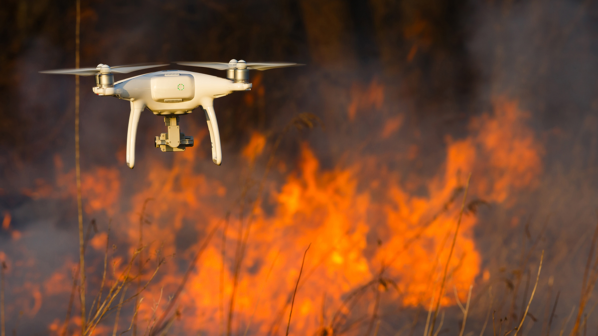
CNET reports that the California Air National Guard is using drones like military grade unmanned aerial vehicles (UAV) to keep track of how huge wildfires are spreading. Some drones can also stay in the air for hours at a time, giving firefighters valuable insight.
Drones like the MQ09 Reaper UAV can come with lidar technology, a light detection and ranging method that uses light pulses from a laser to measure distances to Earth. Lidar can create 3D maps that outline everything from power lines to trees, helping rescuers see any fire hazards that might get in the way. Bigger drones have the capability to carry items with them, allowing cellphones, lights, or radios be dropped to people in need.
Drones with real-time analytics are a need for many different industries. Earlier this year, Cisco announced its investment in Kespry, an industrial aerial intelligence program. The company outlines several use cases where drones can be applied: crop health assessment, mapping forest areas, and search and rescue. In the mining industry, drones can help map mines based on operational metrics like volume, cut, and tonnage. This is done by capturing drone footage data that is transmitted to the Kespry Cloud, where the data is then converted into 3D models using AI. Reducing errors with these maps can prevent danger or injury.
Aerial vehicles on the forefront of disaster relief and industry safety show how technology is a necessity during crisis. Cisco Tactical Operations (TacOps) team helps bring the necessary tech and aid to those who need it most. During Colorados Waldo Canyon Fire in 2012, TacOps was able to head to the scene to bring a communications and wireless network for firefighters and those helping evacuate residents. This wildfire burned 18,000 acres, leaving many in need of critical information. The Cisco Network Emergency Response Vehicle (NERV) was used as a mobile communication center, helping hundreds to connect to each other quickly.
To learn more about what TacOps is doing around the world, check here.
###
[i]We welcome the re-use, republication, and distribution of The Network content. Please credit us with the following information: Used with the permission of http://thenetwork.cisco.com/.[/i]
( Press Release Image: https://photos.webwire.com/prmedia/6/227905/227905-1.jpg )
WebWireID227905
This news content was configured by WebWire editorial staff. Linking is permitted.
News Release Distribution and Press Release Distribution Services Provided by WebWire.